Best Handheld GPS for Sailors
Your fixed chartplotter is the boat's primary navigation system — right up until a fuse blows, a strike takes out the 12V bus, or the nav station floods. A handheld GPS is the piece of gear that keeps you navigating when the primary system doesn't. This guide covers how to pick one that actually earns its place in the ditch bag: waterproofing that matters, battery choices that don't leave you stranded, chart data versus a bare position readout, and where satellite messaging crosses over into safety gear. For the fixed-mount side of the picture, see our best marine GPS and chartplotter guide, and pair any handheld with a proper handheld VHF radio for a complete backup kit.
Sailboat Atlas may earn a commission from qualifying purchases made through links on this page, at no extra cost to you.
Why a handheld is the essential backup to a fixed chartplotter
A fixed chartplotter is wired into the boat's electrical system and antenna — which is exactly why it's vulnerable to exactly the failures that matter most offshore: a lightning strike, a flooded bilge that takes out the DC panel, a corroded connector that finally lets go three days out. A battery-powered handheld with its own GPS antenna doesn't share any of those failure points. It's not meant to replace your primary chartplotter day-to-day; it's meant to still be working on the one day the primary system isn't. That's also why it belongs in the ditch bag, not the nav station — if you have to abandon ship, you take it with you.
Marine handhelds vs hiking handhelds — the real difference
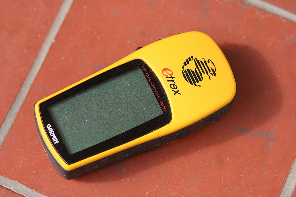
Garmin sells both marine-branded handhelds (GPSMAP 79sc, 86i) and hiking-branded handhelds (eTrex line), and the hardware inside is often similar. The differences that matter on the water are: preloaded marine chart compatibility (BlueChart g3 vs a land-only basemap), a floating hull so a drop over the rail doesn't mean a $400 loss, and a screen tuned for glare off open water rather than tree-canopy shade. A hiking GPS will still give you a reliable lat/long fix and get you back to a waypoint, but it can't show you a channel, a shoal, or an aid to navigation the way a marine unit with real chart data can.
Waterproofing and floating designs — IPX ratings explained
IPX7 means the unit survives immersion to about 1 meter for 30 minutes — fine for rain and spray, and fine for a quick dunking, but not the same as floating. IPX8, used on some handheld VHF/GPS combos, rates deeper and longer submersion. Separate from the IP rating is whether the unit actually floats face-up if it goes over the side — Garmin's marine-branded handhelds (79sc, 86i) do; the eTrex line does not. If a unit is going to live loose on deck or get handed around the cockpit, floating matters as much as the waterproof rating on the box.
Battery life: AA vs rechargeable, and why it matters offshore
AA-powered handhelds (79sc, 86i, eTrex) can run on standard or lithium AA cells that you can buy in any port in the world, or carry a fistful of spares in the ditch bag with essentially indefinite shelf life. Rechargeable-only devices need a working charger and a power source — fine on a boat with functioning electronics, useless in the exact scenario a backup GPS exists for. If you're provisioning for offshore passages, lithium AA cells and a spare set are cheap insurance; keep the unit itself off and untouched between checks so the batteries last seasons, not months.
Preloaded marine charts (BlueChart g3) vs topo basemaps
Garmin's marine handhelds ship with BlueChart g3 coastal coverage preloaded, meaning depth contours, navigation aids, and marine hazards are usable the moment you turn the unit on — no memory card purchase required, unlike Garmin's fixed chartplotters which often need charts bought separately. Hiking-focused units carry only a topographic basemap that treats the ocean as a blank area past the coastline. If a listing doesn't specifically mention BlueChart or marine chart compatibility, assume it's land-only and budget accordingly.
Satellite messaging crossover: when a GPS becomes a distress device
Garmin's inReach technology blurs the line between navigation and safety gear. The GPSMAP 86i and the standalone inReach Mini 2 both add two-way satellite texting and an SOS button that routes through a 24/7 monitored response center — a meaningfully different (and better) capability than a one-way PLB, because rescuers can text back and confirm help is coming. The tradeoff is an ongoing subscription cost, absent from a plain GPS or a beacon like the ACR ResQLink. See our EPIRBs and PLBs guide for how these beacons compare against ship-registered EPIRBs for offshore distress coverage.
Grab-bag and ditch-kit use — and practicing the MOB button
A handheld GPS that lives buried in a locker is worth less than one that's charged, checked, and physically in the ditch bag where every crew member knows to find it. Every unit on this list has a dedicated Man Overboard (MOB) button that instantly marks a position and starts showing bearing and distance back to it — but that only helps if someone has actually pressed it before, in daylight, at the dock, so it's reflex rather than a menu they're hunting through during a real crew-overboard call. Build the habit into your season-opening safety check alongside checking your ground tackle and flares.
Our picks
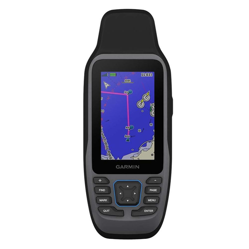
Garmin GPSMAP 79sc
Best floating marine handheld with preloaded charts
The 79sc is Garmin's dedicated marine handheld, and the floating hull is the feature that matters most: drop it off the rail mid-tack and it bobs on the surface instead of sinking to the bottom. Preloaded BlueChart g3 coverage means it's a genuine standalone backup to your fixed chartplotter, not just a GPS position readout. It's the boat's grab-bag unit — permanently in the ditch bag, batteries checked every season.
- Waterproofing
- IPX7, floats face-up if dropped overboard
- Charts
- Preloaded BlueChart g3 coastal charts
- Battery
- 2x AA, roughly 18 hours
- Typical price
- $400–$450
Pros
- Purpose-built marine handheld — floats, and the screen is legible in full sun
- Preloaded charts mean it's usable straight out of the box, no card purchase required
- AA batteries are replaceable anywhere in the world, including mid-ocean
Cons
- Screen and processor feel dated next to a modern chartplotter or phone app
- No touchscreen — button navigation is slower for zooming and panning
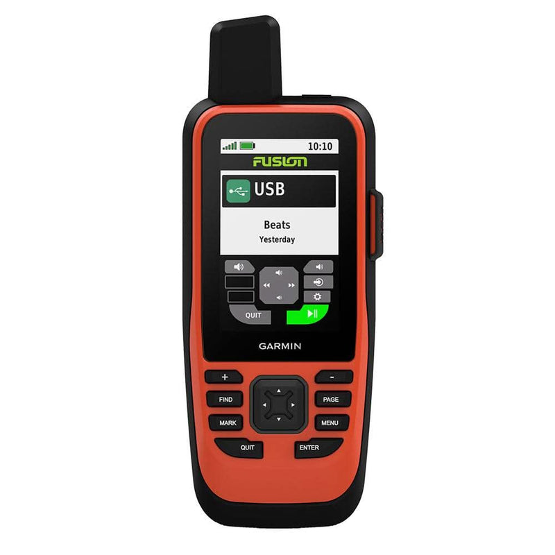
Garmin GPSMAP 86i
Best handheld with satellite messaging built in
The 86i is the answer to 'why carry two devices?' It's a full marine GPS with preloaded charts and it's also an inReach satellite communicator, so a single grab-bag unit gives you both chartplotting and two-way emergency messaging outside cell and VHF range. The subscription is the ongoing cost that a plain 79sc doesn't have, but for offshore passages the two-way SOS confirmation is worth the premium over a beacon-only PLB.
- Waterproofing
- IPX7, floats
- Satellite
- Built-in inReach two-way messaging and SOS (subscription required)
- Charts
- Preloaded BlueChart g3 coastal charts
- Typical price
- $650–$700
Pros
- Combines a marine chartplotter handheld with inReach satellite messaging in one unit — no second device
- Two-way SOS through the Garmin Response Coordination Center, with tracking and text messaging anywhere
- Floats and is built to the same marine-handheld ruggedness as the 79sc
Cons
- Requires an ongoing satellite subscription to unlock the messaging and SOS functions
- Significantly more expensive than a chart-only handheld — pay for capability you need to actually use
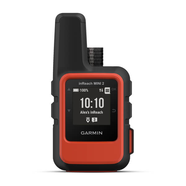
Garmin inReach Mini 2
Best lightweight satellite communicator (pair with a chart app)
The Mini 2 isn't a chartplotter substitute — it's the crossover safety device that belongs on every offshore crew member's body, separate from the boat's dedicated marine GPS. Clip one to each harness for overnight watches; if someone goes over the side and the boat doesn't turn back fast enough, this is what calls for help. Buy a GPSMAP unit for boat navigation and an inReach Mini 2 per crew for personal safety — they solve different problems.
- Weight
- 3.5 oz — clips to a PFD or harness
- Satellite
- Iridium two-way messaging, SOS, tracking (subscription required)
- Charts
- None — position/messaging only, pair with a phone chart app
- Typical price
- $350–$400
Pros
- Smallest, lightest satellite communicator on the market — easy to clip to a harness for every watch
- Two-way texting with family or shore support works globally, independent of cell coverage
- Pairs with the Garmin Explore app on a phone to add mapping the unit itself lacks
Cons
- No built-in charts or screen mapping — it's a messaging and tracking device, not a chartplotter
- Small buttons and tiny display make it awkward as your only navigation backup
Garmin eTrex SE
Best budget backup GPS (no marine charts)
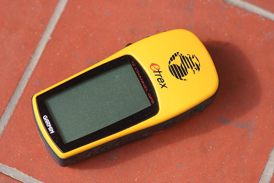
The eTrex line is designed for hikers, not sailors, and it shows — no BlueChart compatibility, no floating hull. What it does give you is a genuinely rugged, cheap, AA-powered backup that will hand you a reliable position and a route back to a waypoint when everything else has failed. For a coastal daysailor on a budget, or as a third-string spare in the ditch bag behind a proper marine unit, it earns its keep.
- Waterproofing
- IPX7
- Charts
- Basemap only — no BlueChart marine charts available
- Battery
- 2x AA, roughly 25 hours
- Typical price
- $130–$160
Pros
- Cheapest genuinely rugged handheld worth owning — a real backup, not a toy
- AA battery life is excellent, useful for long passages where you're conserving power
- Simple, durable, and easy for any crew member to operate under stress
Cons
- No marine chart support and doesn't float — it's a hiking GPS pressed into marine service
- Screen is small and monochrome-adjacent; fine for a lat/long fix, not for real chart navigation

Standard Horizon HX890
Best handheld VHF with integrated GPS
The HX890 earns a spot on this list because most boats already carry a handheld VHF, and this one folds GPS and DSC distress calling into that same unit. If your primary systems fail, pressing the red DSC button broadcasts your exact GPS position to any DSC-equipped vessel or the Coast Guard on channel 16 — arguably more useful in a real emergency than plotting a course. Pair it with a dedicated chart-capable handheld rather than relying on it alone for navigation.
- Waterproofing
- IPX8 submersible, floats
- GPS
- Built-in GPS with DSC position transmission and simple mapping
- Radio
- 6W handheld VHF with full DSC
- Typical price
- $180–$220
Pros
- One device covers backup VHF and backup GPS — fewer things to grab in an emergency
- DSC distress button transmits your GPS position automatically over VHF channel 16
- Floats and is fully submersible, tough enough to live in a cockpit pocket full-time
Cons
- GPS mapping is basic — no real chart overlay, just position and a simple track/waypoint display
- Battery life is shorter than a dedicated GPS unit since the radio draws more power
ACR ResQLink 400 PLB (complementary distress option)
Best last-resort backup when GPS and VHF both fail
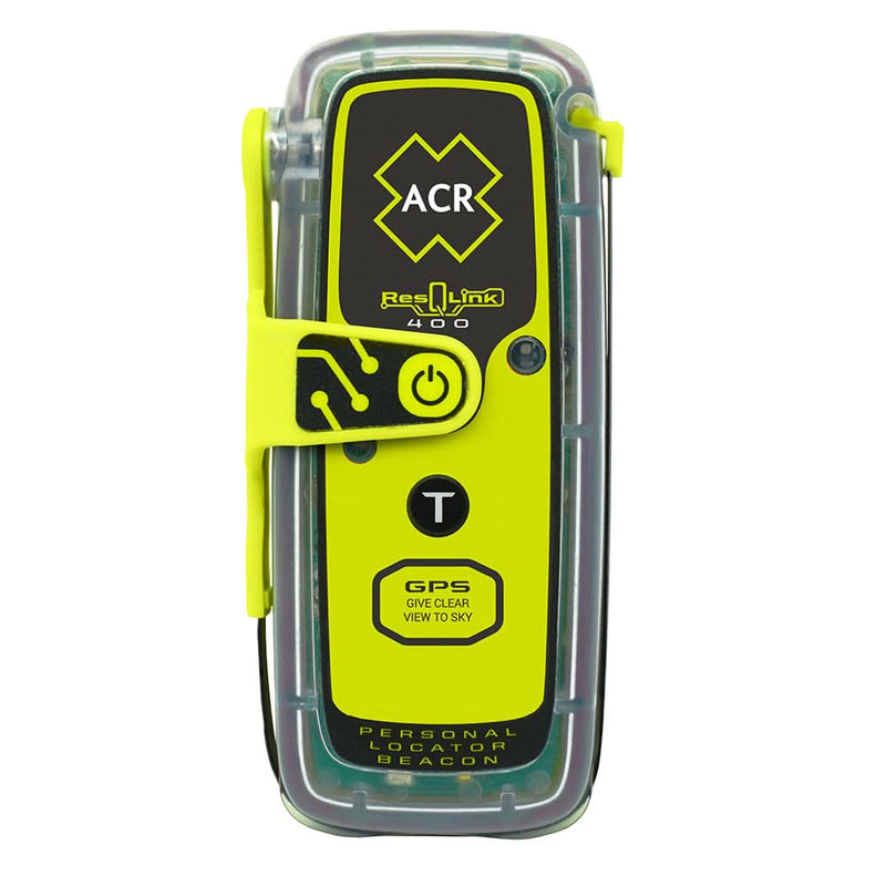
A PLB isn't a navigation tool, but it belongs in this guide because the honest answer to 'what if my handheld GPS also dies' is a beacon, not another GPS. The ResQLink 400 is the fallback below your fallback: if the GPSMAP unit floods, the battery dies, or you're in the water without either, this is what brings a rescue helicopter to your exact position. See our <em>EPIRBs and PLBs</em> guide for the full comparison against ship-registered EPIRBs.
- Type
- Personal locator beacon, buoyant, GPS-equipped
- Battery
- 5-year replacement, 28-hour operating
- Signal
- 406 MHz distress + 121.5 MHz homing, no two-way messaging
- Typical price
- $300–$375
Pros
- Works through the Cospas-Sarsat satellite network with no subscription and no cellular or line-of-sight dependency
- Small enough to clip permanently to a PFD or ditch bag alongside your handheld GPS
- No batteries to manage day-to-day — it sits ready for years between checks
Cons
- One-way distress only — no chart, no messaging, no confirmation your position reached rescuers in real time
- Registered to a person, so coordination with the vessel's own EPIRB (if any) matters in a real incident
How to choose
| Product | Price range | Best for | Key spec |
|---|---|---|---|
| Garmin GPSMAP 79sc | $400–$450 | Floating marine backup with charts | Preloaded BlueChart g3, floats, AA power |
| Garmin GPSMAP 86i | $650–$700 | Chart + satellite messaging in one unit | Built-in inReach two-way SOS |
| Garmin inReach Mini 2 | $350–$400 | Per-crew personal safety device | 3.5 oz, global two-way texting |
| Garmin eTrex SE | $130–$160 | Budget backup, no marine charts | ~25 hr on 2x AA |
| Standard Horizon HX890 | $180–$220 | Combined backup VHF + GPS | DSC distress with GPS position |
| ACR ResQLink 400 PLB | $300–$375 | Last-resort distress backup | 406 MHz, no subscription |
Budget tier ($130–$200): Garmin eTrex SE, or a Standard Horizon HX890 if you need a backup VHF anyway and can live with basic GPS mapping. Mid tier ($350–$450): Garmin GPSMAP 79sc for full marine chart capability plus a floating hull, or an inReach Mini 2 clipped to each crew member's harness for offshore watches. Premium tier ($650+): Garmin GPSMAP 86i, which folds chartplotting and satellite SOS into one grab-bag unit — the right call for bluewater passages where minimizing the number of devices in the ditch bag is itself a safety decision.
Related guides
 Navigation
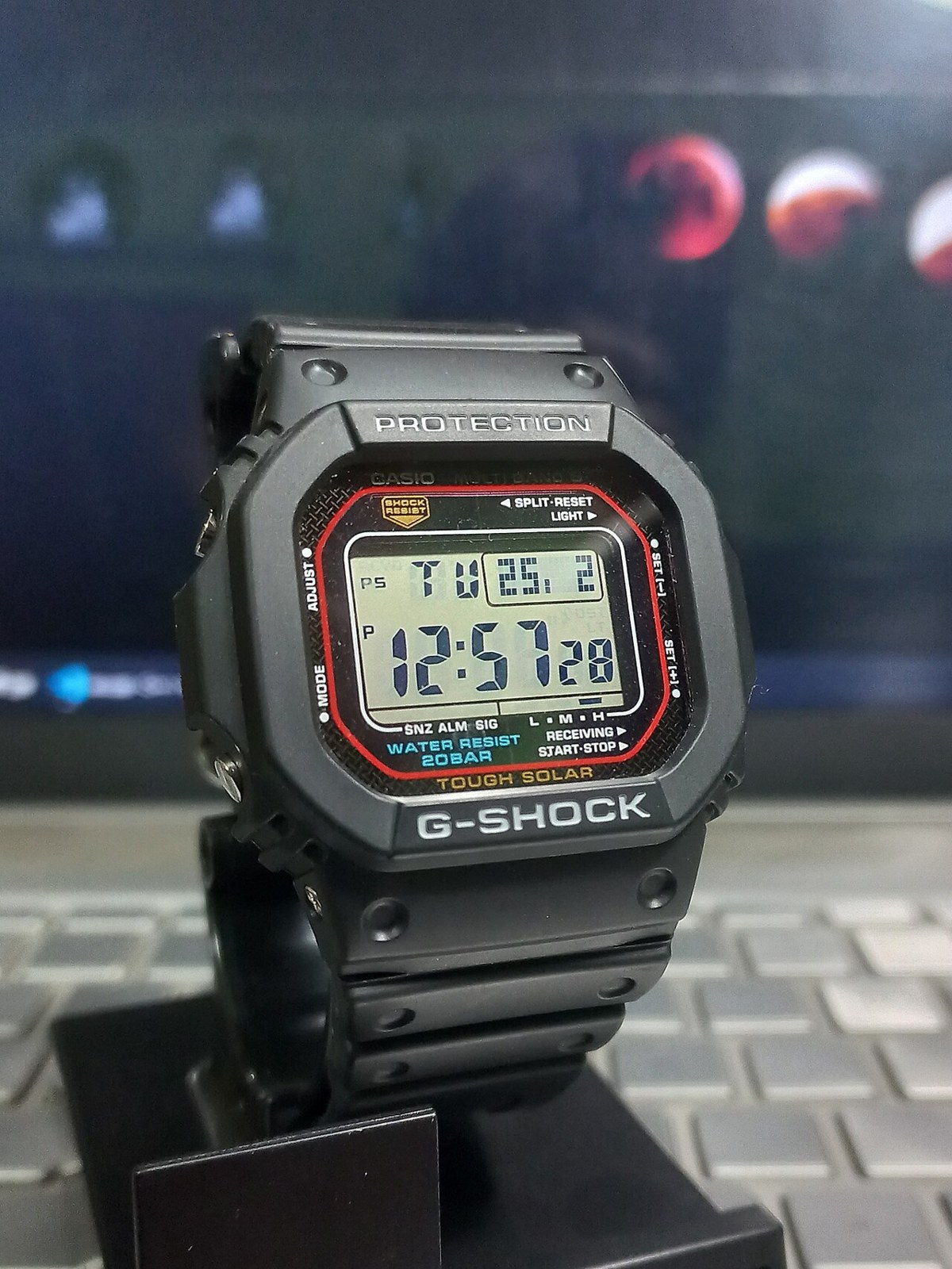
Sailing Watches: Race Timers and Cruising Choices
Countdown controls, water resistance, readability and battery care: choosing a practical watch for racing and cruising.
 Navigation
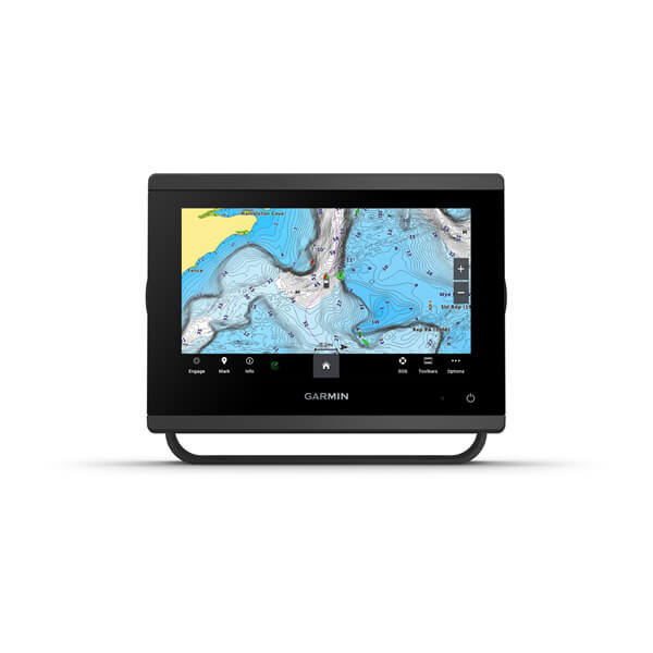
Best Chartplotters for Sailboats
How to choose a chartplotter for cruising — screen size, charts, networking, and top picks at each budget.
 Navigation
Best Sailboat Autopilots
Raymarine, B&G, Garmin, Simrad and Pelagic autopilots compared — drives, sailing modes, and integration.
- Navigation
Satellite Communications for Sailors: Starlink, Iridium, inReach
Satellite comms for cruising sailboats — Starlink Mini, Iridium GO, Garmin inReach, and how to combine them.
Looking for more gear guides? Browse all our gear recommendations or the full guides index.